A Stronger Future
The 2022 Georgia Smart Communities Challenge spurred smart resilience innovation throughout the state.

Diverse Projects: Debra Lam, founding director of the Partnership for Inclusive Innovation; photo Daemon Baizan.
As the temperatures drop this winter, you may find yourself turning up the heat a little each day, only to regret it when the bill comes. That was the case for one older Atlantan who struggled to pay her heating bill – until she took part in a project designed to help her community make the most of their energy use without forgoing comfort.
Her story is part of the Georgia Smart Communities Challenge, hosted by the nonprofit Partnership for Inclusive Innovation (PIN), which pairs community leaders with higher education researchers to tackle complex problems through innovation and collaboration. The 2022 cohort designed projects around the theme of smart resilience, with projects reflecting the diverse needs of communities big and small across the state.
That diversity is by design, says Debra Lam, founding director of PIN, which is a public-private coalition. “True to their nature, they are communities of all sizes, and there are a range of projects. The reason behind that is we don’t believe that there’s one kind of development, nor do we think that this type of innovation is exclusive to one type of community.”
“Our main mission at the partnership is about shared economic prosperity, so [it’s] knowing that innovation can be spread out and accessible for more people, organizations, places and communities.” Debra Lam, founding director, Partnership for Inclusive Innovation
The 2022 group includes project teams from Atlanta, Athens-Clarke County, Warner Robins and Henry County, which interpreted “smart resilience” to address homeowner energy-burden reduction, climate change preparations, algorithm-driven crime prevention, and data-driven development assistance, respectively.
Retrofitting Atlanta
In the southside community of Thomasville Heights, a project called Building Strategies for Energy-Efficient Retrofits focused on a home’s energy burden – or the relative amount of a household’s income that goes to energy spending – and how simple home retrofits could reduce energy consumption and cost as well as improve resident health and comfort.
The project team targeted Atlanta’s Thomasville Heights neighborhood because it ranks in the top 7% for energy burden in the state – meaning these homeowners spend some of the largest portion of their income on energy costs in Georgia.
Researchers from the Georgia Tech Flourishing Communities Collaborative Lab (FCCL) and High Performance Building Lab (HPBL) worked with project partners from the city of Atlanta, Morehouse School of Medicine, Bird Family Insulation and the nonprofit Focused Community Strategies on the pilot program, which included 16 homes.
The first step was to determine each home’s energy use baseline. Outdoor aerial thermography and blower door tests checked for energy leaks around the home. For more qualitative data, homeowners completed a survey about their perceptions of energy use in their house. The team also collected energy bills for the previous 12 months to compare energy costs before and after retrofits.

Energy Improvements: Left to right, High Performance Building Lab Director Tarek Rakha, Research Fellow Max Doersam and Flourishing Communities Collaborative Lab Director and Founder Julie Ju-Youn Kim helped homeowners improve energy efficiency; Joanne Vitelli
The retrofits themselves were straightforward: replacing traditional incandescent light bulbs with energy-efficient LED light bulbs, sealing or repairing HVAC ducts, adding attic insulation, sealing around pipes and cracks in walls, and installing weatherstripping around windows and doors.
And it worked. The aforementioned senior citizen indicated prior to the project, her budget was stretched rather thin with her fixed income, but the retrofits lowered her utility bills, while also making her house warmer in the winter and cooler in the summer.
“These are relatively inexpensive projects. This was the idea that guided our effort,” says Julie Ju-Youn Kim, research lead, chair of the Georgia Tech School of Architecture and founder and director of the FCCL. “We wanted to establish a simple set of improvements that are economical and relatively easy. The hope would be that a homeowner could do these retrofits themselves.”
After the retrofits, researchers saw improvements in every category measured, with the largest increase in homeowner comfort. Post-project surveys showed a 92% increase in comfort, with the percentage of homeowners reporting it was easy to cool their home rising to 69% after retrofits compared to only 8% before. The survey also showed the homes had a 25% decrease in air leakages from pre- and post-retrofit blower tests and a 9% decrease in energy use based on energy bills.
“Energy burdens disproportionately affect those members of our community who can afford it the least,” Kim says. “With simple measures such as what we implemented, these simple weatherization techniques have the potential to contribute to long-term benefits such as health, wellness, comfort and building envelope integrity.”
Climate Planning in Athens-Clarke County
The Athens Community Climate Resilience Project took a multipronged approach to climate disaster preparedness. Part community engagement, part information gathering and part community planning, the project’s end result is a community that is more aware of its climate risk, better connected across government and academia, and actively engaged in ongoing climate discussions.
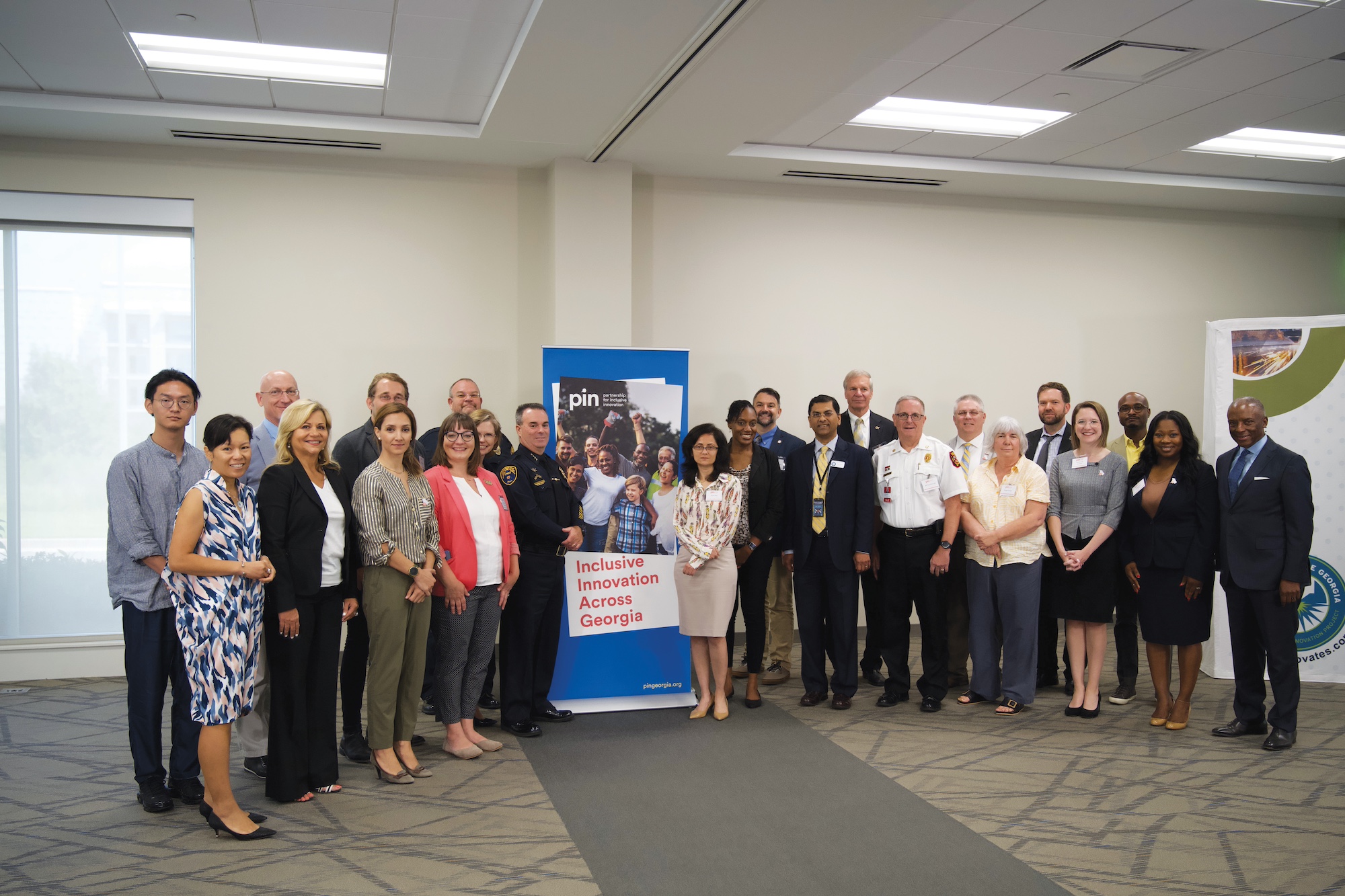
Team Effort: The 2022 group included nonprofits, local municipalities and researchers from seven state universities; photo contributed.
“[The project] served as sort of a reality check for us,” says Joseph D’Angelo, chief data officer for Athens-Clarke County. “We’ve got challenges that exist here that may not exist in other locations, and this project … really taught us as a community to think about where our vulnerabilities lie and what we would do to offset those vulnerabilities in the event of a disaster, and then also what disasters might befall us.”
The team focused on flooding events after assessing the area’s vulnerabilities. Researchers from Augusta University, Kennesaw State University and the University of Georgia teamed with the Athens-Clarke County Geospatial Information Office to develop an online map of the county and its flood risk. Residents can use this interactive map to visualize flood risks around their homes and nearby streets. The map can also help them find local emergency shelters and better plan for how they might respond in an emergency.
To engage directly with the community, the team hosted disaster preparation exercises in which participants were able to challenge their perceptions of their own risk and their ability to respond quickly in the case of an emergency.
One participant stressed that learning to listen to others while sorting out what works and what won’t work is vital, while another recalled watching how other communities successfully or not-so-successfully responded to disasters, saying he wanted to be more aware of what type of preparations his family should be making.
A third participant says she learned a great deal about the flow of water in Athens and how to prepare a bag of supplies in case of emergency. She also got information about safe evacuation routes and emergency shelter areas and downloaded the Federal Emergency Management Agency (FEMA) app to her phone.
Afterward, 80% of participants reported that they had a safety plan after the session, compared to only 35% before.
Geospatial and survey data also helped illuminate areas of the county where residents have mobility or accessibility concerns that could significantly impair evacuation in an emergency. This information is leading efforts to identify site resilience hubs across the county – designated buildings where residents can safely gather for shelter in an emergency.
“That’s a conversation that we weren’t previously having as a community,” D’Angelo says. “Now it’s something that’s kind of baked into our processes.”
These community conversations might be the most lasting impact of this project, D’Angelo says. Researching the county’s disaster preparations led to connections among community counterparts that didn’t necessarily exist before.
“I think we have a more aware community now, and I think that we have a platform for continuing our dialogue beyond that,” he says. “The project is about wrapped, but I see the legacy of this project being that now we are much more aware of who our partners are.”
Crime-solving in Warner Robins
In Warner Robins, the Citizen Safety Digital Twin for Community Resilience project used predictive modeling aided by mobile license plate readers to help police officers “predict” where crime would occur in the city, with the ultimate goal of proactively reducing crime.
The Warner Robins Police Department teamed with researchers from the Georgia Tech Network Dynamics Lab to develop a digital twin of the city – a virtual model that allows for deep learning and algorithm-driven simulations.
The Warner Robins digital twin used historical crime data to extrapolate where crime was most likely to occur in the city each week. The police department used these predictions to strategically place 10 mobile license plate readers across the city, moving them each week to where the model showed they would be most effective. While deployed, the cameras collected license plate data to help officers solve crimes. The model enabled the police department do more with less, says Angie Gheesling, team lead and Development Authority of Houston County executive director, and maximize its resources, both human and machine.
“It’s viewed now as a force multiplier,” she says. “We’re looking at law enforcement agencies all over the country that are struggling with staffing up, and also there’s a big concern about safety for officers. This as an added opportunity for the officers has been able to accomplish just that.”
But how does the public feel about computers predicting crime and placing cameras around their community? Overall, pretty positively, says Elaina Behounek, project research partner from Middle Georgia State University. While community members supported crime-reduction measures in the city, they were concerned about project oversight and how the data would be used. The key to continued support, Behounek says, is transparency and open communication about how the police department plans to use these license plate readers and the data they collect.
And what did the data show? From May to July 2023, when the dynamic license plate readers were in use, crime incident counts in Warner Robins were lower than crime counts from the same period in 2022. Crime rates saw the biggest dips in burglary, larceny, narcotics and vandalism from January to June 2023 compared to the same period in 2022. The team also saw that crime reduction correlated with placement of the license plate readers – where the cameras moved, crime rates were lower.
Though the team collected just under three months of data in this project phase, Gheesling is optimistic about the project’s potential impact on communities around the state.
“It’s not just an experiment. There’s an end goal in sight, and that is having positive effects on Georgia communities,” she says. “For ours in particular, I’m just proud that we’ve been able to tap into an area that is really considered to be in crisis across the country and help communities see how they can use this force multiplier … and truly have such positive results.”
Handling Freight in Henry County
For logistics-heavy Henry County, balancing new logistics developments – and the freight traffic they bring – with county planning priorities and public preference can be tricky. With so many variables to consider, how can county leaders best assess freight-centric proposals?
The Henry County Smart Resilience Decision Support Tool aims to answer that question. Developed by the Henry County Transportation Planning Department in partnership with researchers from Georgia Tech and Clayton State University, the computer-based tool weighs considerations across five factors to help county leaders make more holistic development recommendations in seconds.
Carlotta Harrell, chair of the Henry County Board of Commissioners sees both the upside and the downside of proposed warehouses, logistics centers, and manufacturing centers. “These freight-related developments bring jobs and tax revenue to Henry County, but then they also bring a lot of truck traffic and cause a lot of congestion,” she says. “The tool basically gives us a data-driven way to plan for the best development in our area.”

Data-driven Development: Shamsul Baker, Henry County transportation planning director, and Henry County Commission Chair Carlotta Harrell with the Smart Resilience Support Tool on screen; photo JOann Vatelli.
The tool quantifies land parcel characteristics across five categories: environmental, social, transportation and land use factors and public opinion. Environmental factors include greenspace, park locations and areas particularly sensitive to noise, air or water pollution. Social factors consider the locations of vulnerable populations, while transportation factors measure local road congestion and distance to I-75. Land use factors include zoning, future land use designations, structural density and land attributes. And community surveys gauge the public’s perception of where proposed freight developments should – and should not – go.
The tool is designed to supplement other county planning measures, such as the Henry County comprehensive plan, transportation plan and future land use map, says Shamsul Baker, Henry County transportation planning director.
“Now I have this additional tool available to me to check and make recommendations to our commissioners whether or not … we should approve or should make some changes” to developer proposals, he says.
“It helps us to plan better for our community. It helps us to make better decisions,” Harrell adds. “I think that it helps us to determine what best fits in our community, and it takes [in] all of the factors so that we are protecting those that live in and about and around our community, as well as still being able to allow these various industries to have a place in the community that impacts this region – not just the Atlanta region, but the Southeast region.”
“These freight-related developments bring jobs and tax revenue to Henry County, but then they also bring a lot of truck traffic and cause a lot of congestion. The tool basically gives us a data-driven way to plan for the best development in our area.” Carlotta Harrell, chair, Henry County Board of Commissioners
PIN provided financial and technical assistance to project teams throughout the year to support the projects, and the 2022 cohort included nonprofits, local municipalities and researchers from seven state universities. According to Lam, the program benefits everyone involved: Local communities gain a temporary research and development arm, while university research teams strengthen their research with real-world implementation and community feedback.
“Ultimately, all of this work is about improving the quality of life and improving the human condition,” Lam says. “Our main mission at the partnership is about shared economic prosperity, so [it’s] knowing that innovation can be spread out and accessible for more people, organizations, places and communities.”